It is interesting how the best laid plans change. It has been an enjoyable time spent in Fairbanks Alaska. We even discovered the Osprey nest  on the Steese Highway mentioned in the Milepost. I have also spent time practicing my landscape framing and composition when it comes to using my new lens.
  This lens is the one I will be using for taking pictures of the Aurora Borealis (Northern Lights). I am looking forward to attempting to capture at least maybe one night. But I know numberous things have to come together, like the solar flares, the lack of clouds, darkness, location, and timing. The practice of shooting at night is getting close as it is now getting dark around midnight. Side note on the darkness factor I’m amazed at how much energy I feel from the sun. I do have the location this is going to be Yellowknife Northwest Territories (NWT), there is a park we are staying at that is supposed to be a great place for the Northern Lights. The timing is the end of August.
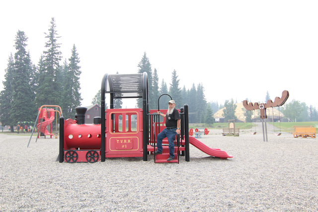
We’ve also spent the time in Fairbanks exploring Fairbanks itself, the Farmers Market, I have gotten my raw garlic fix, Roy did discover a salsa that he loves, I enjoyed seeing the homemade crafts and I even bought some. Pioneer Park, this is where we were able to rent two scooters to make it more enjoyable for both Roy and myself.
A little outside of Fairbanks is Chena Hot Springs we were going to be staying on this road for a few days, the fire that occured made us change plans. I am beginning to believe that this trip is happening just the way it should. Roy wanted to camp on a sandbar actually a gravel bar, we did drive on one though. 
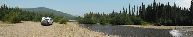
The campgrounds on the Chena Hot Springs Road were well maintained and level. So we were able to do the drive out to Chena Hot Springs as a day trip. The smoke from the fire had blown away you could see it in the distance and every once in a while you would get a sniff.
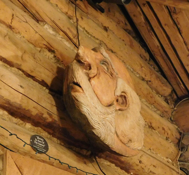
Chena Hot Springs is definitely touristic https://chenahotsprings.com/ .  The lodge was an original log cabin. Bear rug on the ceiling pictures of the aurora borealis. I think Roy posed for the man
  looking up in the sky which is also inside the lodge. The grounds are home to the ice museum
  https://chenahotsprings.com/icemuseum. There are also old rusted cars,
  farm equipment, and mining equipment


A private airstrip adds to the resort .
.
This was just one of the day trips we’ve taken over the time in Fairbanks. We also took one of the nights to take advantage of the local baseball team the Alaska Goldpanners https://en.wikipedia.org/wiki/Alaska_Goldpanners_of_Fairbanks they are a college summer league. I was quite smitten by the mascot as you can tell from this picture.  I think this is because of his beard. This is the team’s last home series of the season, the news said it would be a challenge for the Goldpanners. The home team won 17 – 10 no challenge there. He played the kazoo during the 7th inning stretch.
  Here’s a link to the official website http://goldpanners.pointstreaksites.com/view/goldpanners/home-page-822 The National Anthem was sung by a local women who hit all the high notes.
  Here is an action shot Roy took. Some of the places in the area we’ve returned to a time or two
  LARS and the Steese Hwy (AK 6) to mention just two. Pictures and details to follow


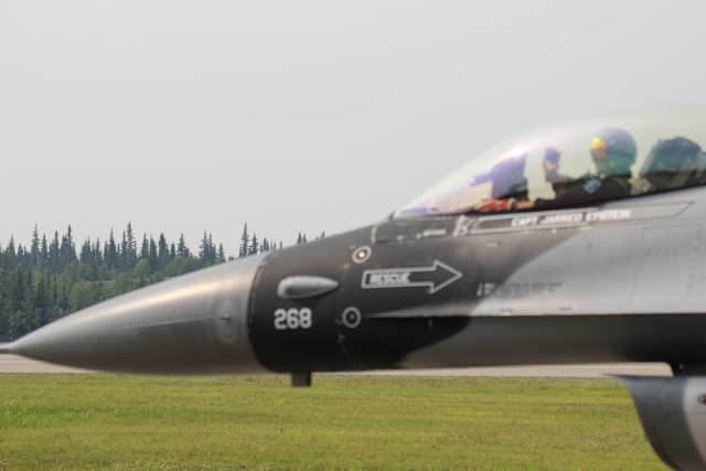
 You can see the vendor tents and people moving around here This was a good thing because the amount of people who were stuck in traffic at the start of the show was amazing. Front row parking and basic front and center on the bleachers for the airshow. Sitting front and center allowed me to wave to the pilots as they did a slow roll down the runway.
 , the warthog (also known as Thunderbolt II), and a B52.
  Also on the ground was a plane that could carry large tanks in their belly.


 I did see it participating in the simulated war game refueling planes in the air.
 I did realize trying to take pictures of these jets is like trying to take in focus pictures of birds in flight only on steroids.
  I am also glad that earplugs were being given out for free.
  (I forgot how loud planes can be).
 I was able to catch the wave of sound right before it would have broken the sound barrier, this link explains what happens.


 in and just bomb it out of existence. The team work is done to minimize collateral damage.
 Air support makes it safe for the ground forces to capture the rocket launcher held be insurgents,
  a bomb tech also was needed to clear any booby traps to make it safe.
 Fairbanks for 8 nights. Mother Nature had some different plans. That picture was one of the nights you could see smoke in town, it also helped us make the decision to stay in town for the next few weeks. We are still planning on driving up the Dalton and leaving the trailer in Fairbanks (baby still needs a rest). As far as driving to circle this might be out of the question because it’s a little far for a day trip. There is still a fire burning by Chena Hot Springs which was in the plans at one time. This past weekend did help some of the fires because of the rain it also cleared the air for the airshow at Eielson Air Force Base. I am ok with this 3 weeks in Fairbanks it will give me enough time to explore plus eat at some good restaurants that we discovered on our last time here.
 ou can see smoke in the pictures. The park itself was large we were able to rent 2 scooters for $10 an hour what better way to get around. Each of the buildings were moved from other areas of Fairbanks and each building has a plaque with where it was originally located.
  The brown building with the white trim was a house of Ill Repute. The park has a train but due to smoke in the air Roy had to settle on this to get his train fix.
 There is also an aviation museum on the grounds of the park. We did not go inside though we are here long enough I think it is worth a trip back.

 and she texted ok now I know it’s legit. I sent back Roy assures me it’s legit so please send money. This is what I got from her
 So the lemons we acquired have already been made into lemonade.
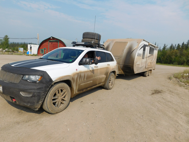
 I will say I really thought Roy having two spares for the Jeep was overkill. It wasn’t. The second day up the Dempster started with a little bit of drizzle not bad at all. We made it passed the Artic circle even got a picture. Then we had just mentioned that the tire monitoring system on the RV had not beeped. Side note this system had been beeping over nothing. All of a sudden we hear a beep and see on the dash that our right rear tire of the jeep is going flat. You know how you just get a feeling, I knew the minute I saw the rock standing up and we hit the it that one of our tires were going to go flat. I hate it when I’m right :).

 It was hard packed and worth the bumpy ride. I did see a caribou he had a nice set of antlers although you don’t get the full effect from the back side picture.
  I was surprised to see this guy, we stopped by the side of the road I got out to look for him. The guy gave me a chance for a headshot but I was surprised to see him looking at me so I missed the opportunity. The result was butt shot. At least I’ve seen a large animal on this trip. Someone posted a herd of caribou crossing this same area the day before. People we met on the road came through the day after we did and were stopped by the same herd. I think our timing is off. 🙂
 The rolling hills and vast views can be almost as striking as having animals in the scene. (my story). We made it through customs at Poker Creek which is the farthest northern US border crossing. That’s what the sign said it also stated that the population of Poker Creek is 3. After a brief stop over at the Walker Fork BLM campground
  and the side trip to Eagle we headed to Chicken Alaska.
 The chicken is above the actual town they do have three chickens of their own. We stayed here three years ago and the town seems to have stayed the same. The place Chicken Gold Camp
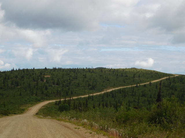
 .
. that we drove through when we were on the Dempster.
  When the signs say road narrows it does. In fact in a couple of spots it is one lane. No worries you can see for miles and the dust cloud warns you that someone is coming. We only had to pull over once to let someone go by that was coming towards us. We drove over a earthquake fault you could not see but you could tell the difference in landscapes. It’s 78 miles from the campsite to Eagle we did it in a whopping 3 hours getting there and 2 1/2 hours coming home. (the extra time was stopping to take pictures I have been working on framing my landscapes).
  I did mention the views didn’t I. 🙂 Side note still no animals
  (unless you count the dog Roy saw) hopefully Yellowknife will be beyond our expectations.
 They still worked and he even pumped the gas for us. $50.00 netted us 11 gallons $4.49 a gallon not bad for the middle of nowhere. In town it was $4.69 a gallon and we would have had to pump it ourselves. It was also cool to sit and chat with him about the local color. When asked how many stay for the winter; he said, ‘there are 78 diehards and 2 freeloaders from California.’ He was definitely outspoken. In small rural backwoods this can still be done.
  We wanted to continue onto town and see the end of the road. It dumps right into the Yukon River,
  in 2009 there was a flood that wiped out at least three city blocks. They have recovered but not all the shops came back.
 I am so glad I stopped because it was a cute shop that also had t-shirts, she starting doing these last year because the store that had carried t-shirts and hats was wiped out by the flood of 09 and no one picked up the torch.


 The good news is they were able to get it extinguished Dawson City will never get a McDonalds as it is a historical site.
 these were built on permafrost before people realized the building had to be raised. This is a replica of Jack London’s cabin
  which also benefits from Gerties profits. Here are some other buildings around Dawson

 It is starting to become a boomtown again, with the edition of a Westmark Inn

 .
. is worth making the trip to Dawson. It was also enjoyable to shop in the only grocery store in town.


 . Some of the snowmobiles had pallets leaning up against them others had sleds attached to them. Roy kept mentioning he was surprised that the vehicles were left alone, I was surprised at how many there were. I was impressed with the winding of the road and how it hugged the water, no animals though. As we were pulling into Tuk there is the Parks Canada Pingo National Landmark. The area contains 8 pingos. Ibyuk Pingo is the tallest one in Canada and the second highest the tallest Pingo is in Alaska. You can actually paddle out to the pingos it is only a 45 minute paddle. Maybe next time.


 e the rolling landscapes were on. You can also see the road that we were headed on a few minutes later. The white you see is the cottonweed. The r
 oad itself looks wet and it was. 🙂 This picture shows how close to the road the clouds were at one point. We kept driving in and out of the clouds all the way to Eagle Plains. I thought it was cool watching the clouds engulf us then we would suddenly be out of the clouds. The funny thing about pictures and promises they can almost not happen. I know I said I would get pictures of the Northwest Territories (NWT) sign, as we approached the clouds just engulfed the signs. Have no fear Roy came through.
  I think the pictures look great in the clouds.
 which are believed to be the Northern most point of the Rockies. Speaking of the rockies we crossed the divide 3 times. Water was flowing into the Artic ocean and the Bering sea. I had a hard time watch water flow basically north.

 This fox has been fed before he was almost begging for food. In fact the trash cans were overflowing and when we pulled in he had already been feasting on the trash. I wish people would think before they do. He kept coming by and sitting down looking like PLEASEEEEEEEEEE!! The fox did finally leave when more people pulled in. He was pretty scruffy because he was wet.
 occurs for 25 kilometers here is just one picture. It looks like it is mud but that is actually a burnt orange color. It is mentioned that you will sometime smell sulfer I did not.

