Well….It’s a deep subject.

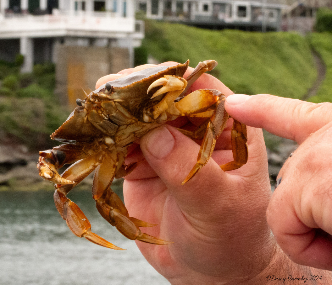
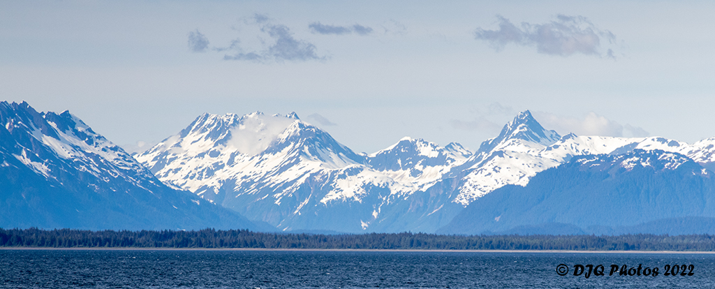
or a hole in the ground.  In this case, it is both. I’ll explain the deep subject soon. After an amazing weekend of firsts, we headed home from Lincoln City OR. Roy had an idea, and some open field running was involved in this trip. As most people know we can no longer pull the Lance trailer with the van we have, however that doesn’t stop us from enjoying the company of fellow Lance campers. The weekend of the 21st of June had the Lance owners gathered in Lincoln City, OR for summer camping in Oregon. We booked a hotel and headed up north. A side benefit was the annual kite festival which I will cover in another post.

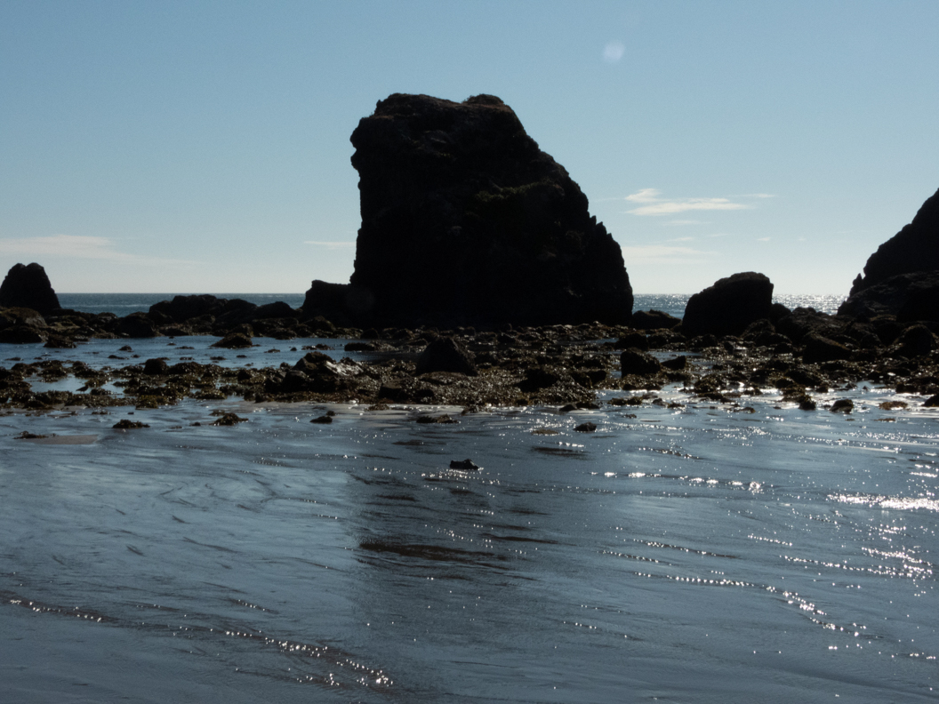
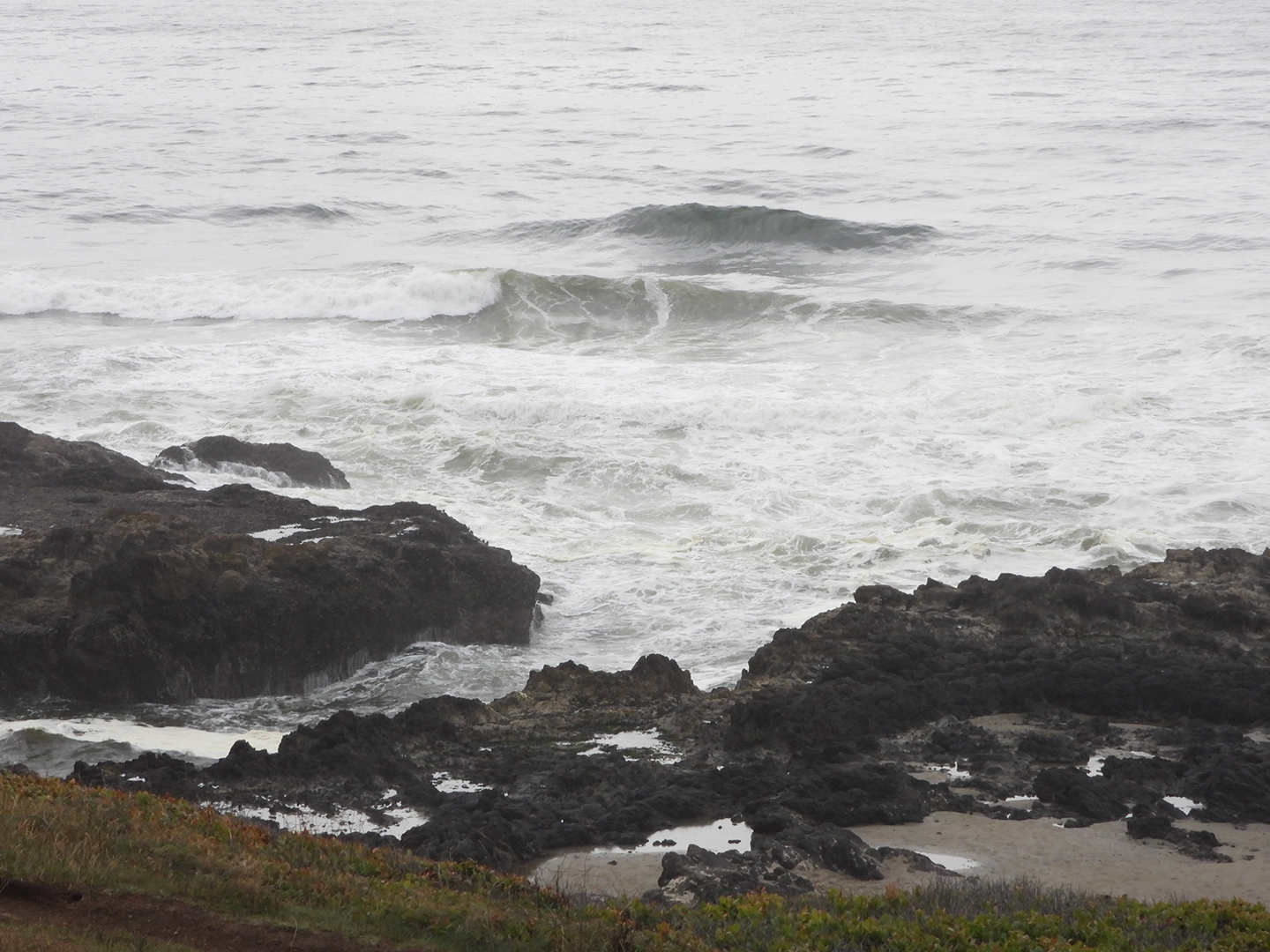
On the way home we stopped at Thor’s Well in Yachats, OR. This is what they call a sink hole. Thor’s Well was suspected to be a cave where the roof fell in. The best part of the well is when you have a wave shoot up through the hole. The other part is when the waves come over the wall and it drains out through the well. The best time to see Thor’s Well however is when it is high tide so you get full effect of pulling the plug in the bathtub.
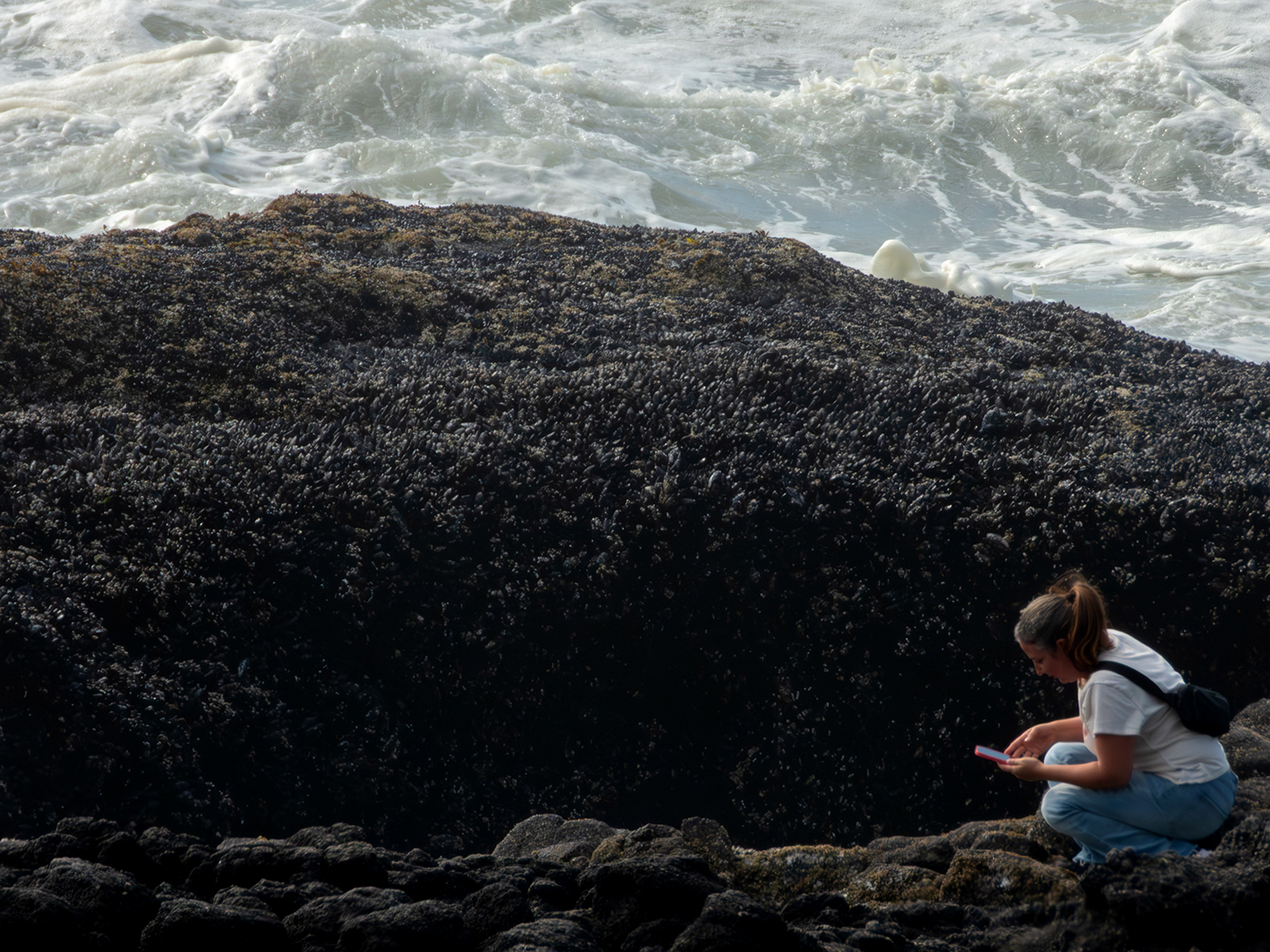
On to the adventures. There is a handicapped accessible path that leads to stairs going down to the actual well. This path also goes down to the tide pool. If I had enough energy I might even have gone to the Cape Perpetua Visitors Center. As it was, I spent over 3 hours taking pictures, talking to people and even helping someone clean up his wounds. Check out the map below to see where Thor’s Well is.

I got out of the van and decided to head out and see what I could see and how close I could get to the well. My ibot can cover rocky ground but not ROCKY ground. I stopped to get my bearings at one of the higher over looks. I had my Nikon P1000 camera which will reach up to 3000mm. So, after the well was pointed out to me, I was able to go up on two wheels and zoom in on the well. Of course, after I went up on two wheels, I had to talk a little about what a game changer the chair is for me. I did answer a few questions about what the chair could do. In answering questions, I was getting information if there was a path I could get close to the well. There is and to my surprise it is paved all the way to the stairs. There is also another path a little steep, but it does head down to the tide pools. So, I knew I would have fun exploring the area.

When I started looking around, I decided to take a video with my camera and zoom as far as my lens would reach. See the video below.

I had a blast watching the look of surprise on people’s faces when the water pops up. It is enjoyable to see the different reactions to the power of the ocean. Right after I took the video, I saw two girls walk up casually to the edge of the Well.

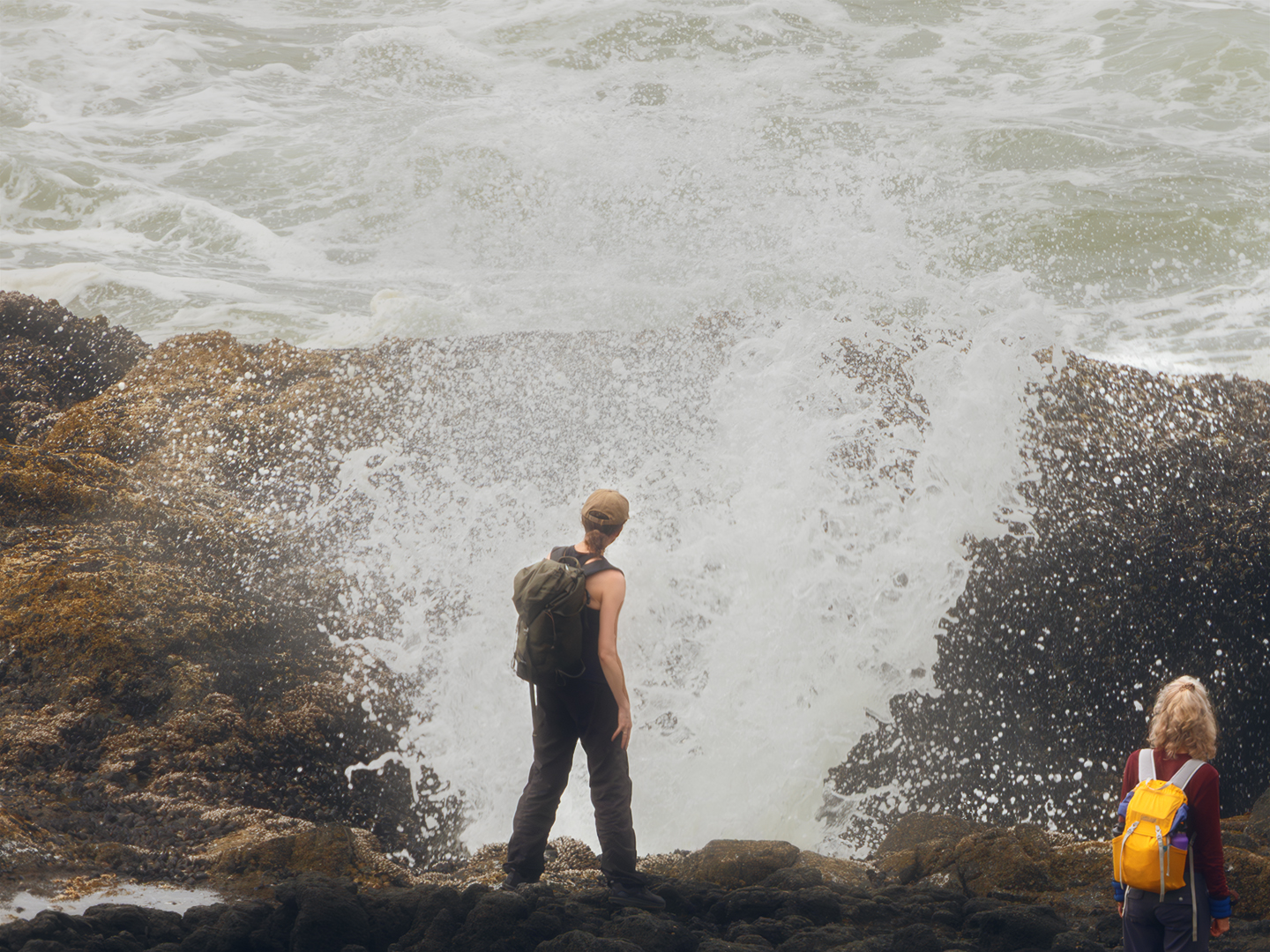
The group of people with me up on the overlook saw a large wave coming in and knew that this will definitely surprise her. (It did.) You can tell she wasn’t expecting it, but the look on her face afterwards was well worth it.

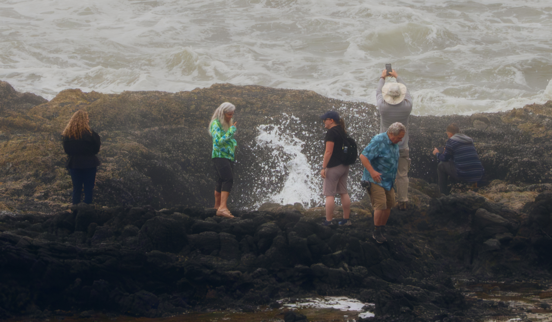
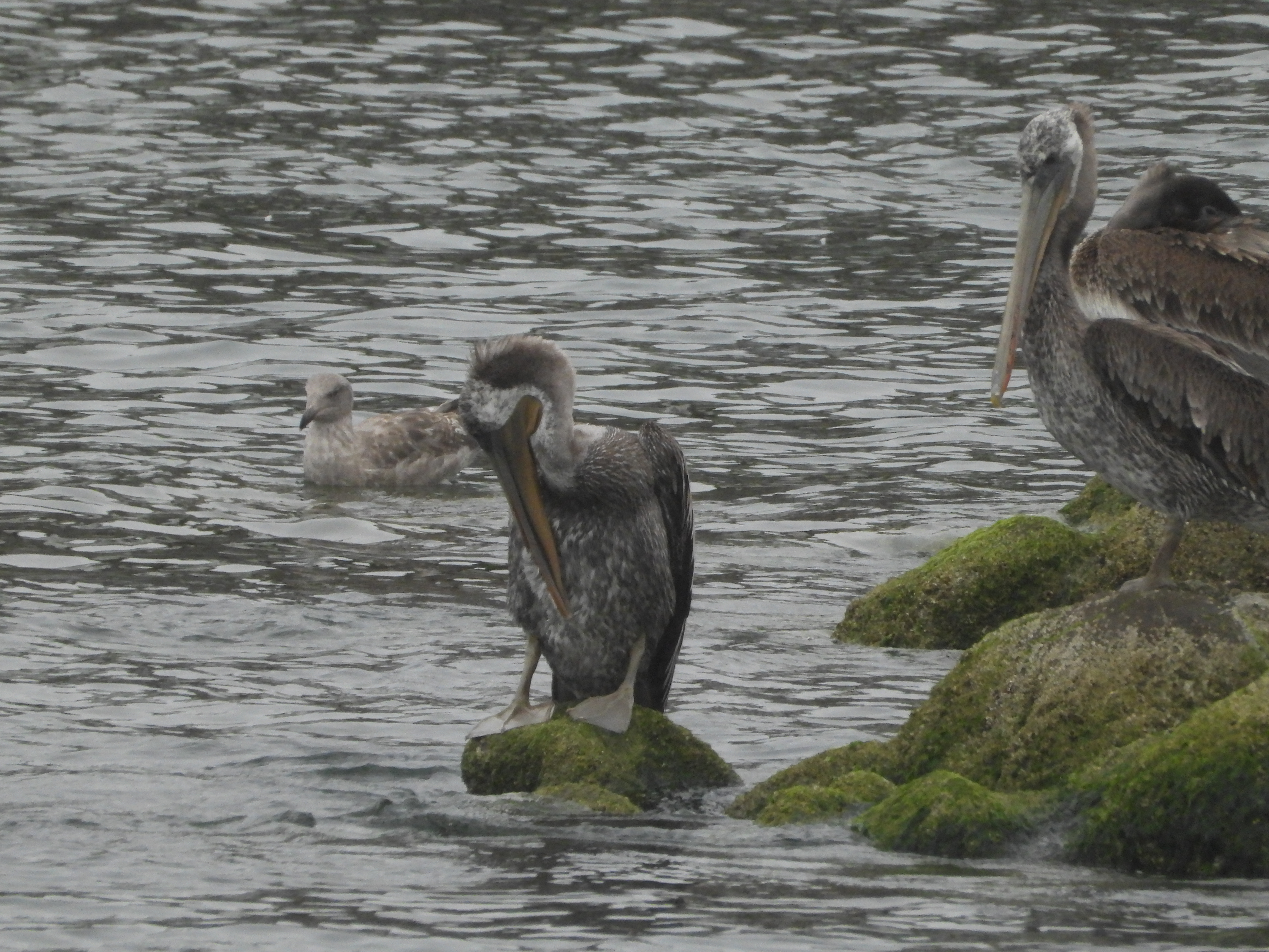
I enjoyed people walking up to the well looking in and turning around I even saw the person I was going to have to patch up. The person in the blue shirt in the image on the left is the one who fell. I headed closer to the stairs and returned to my people watching.

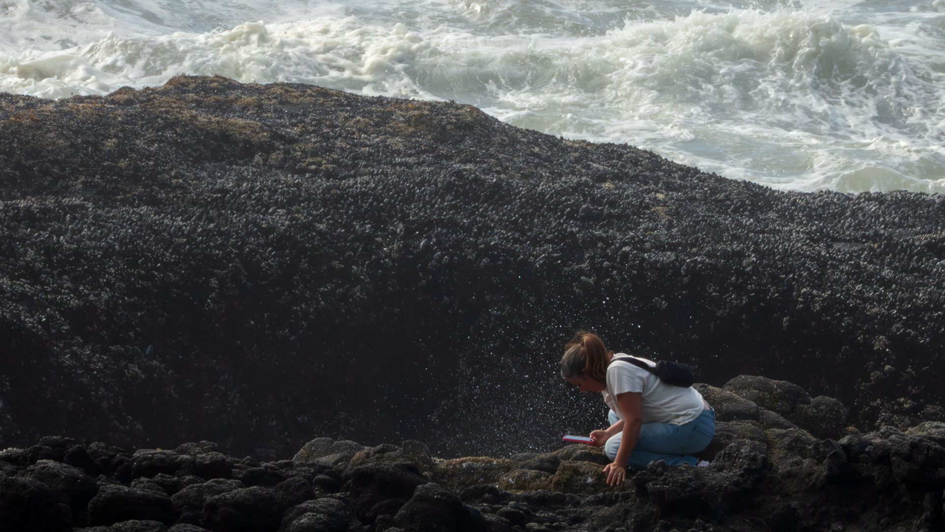
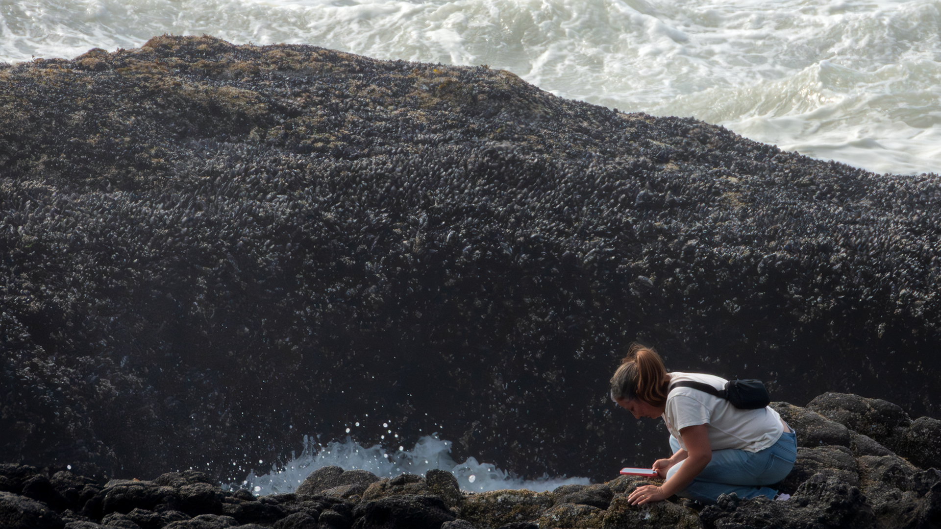
I will say that sometimes when people watching I ask what are you thinking? I had one of those thoughts when I was photographing a woman who I guess wanted to get up close and personal with Thor’s Well and her cell phone. I am just glad she did not drop her phone.

I headed back up to the van just to let Roy know I was still ok, and I was having a blast. (I also wanted to make sure Roy was ok.) I’m greeted however with the question ‘Do we have any band – aids?’ my first thought was ‘oh no, what you do now’? Come to find out it was for the guy in the vehicle next to us. He had slipped on the rock and scratched himself up. We joked a little about what a clutz he was. (It wasn’t until I got home that I found out I had a picture of him.) I asked if he was with anyone and he said his sister and other family. So where are they. ‘Off exploring the trails. They probably don’t even know that I’m hurt’.

After I fixed him up, I was back down another trail. I did run into the sister and let her know her brother was good. She was thankful. I asked how steep the trail was that they came up. Not steep at all. Lesson learned here, do not ask someone who can walk if a trail is steep for a wheelchair. I will say I was a little nervous in some areas of the trail, but I made it.

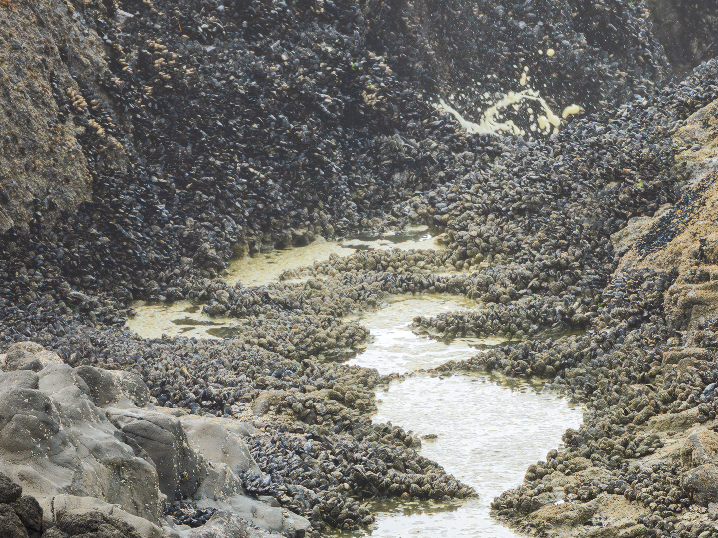
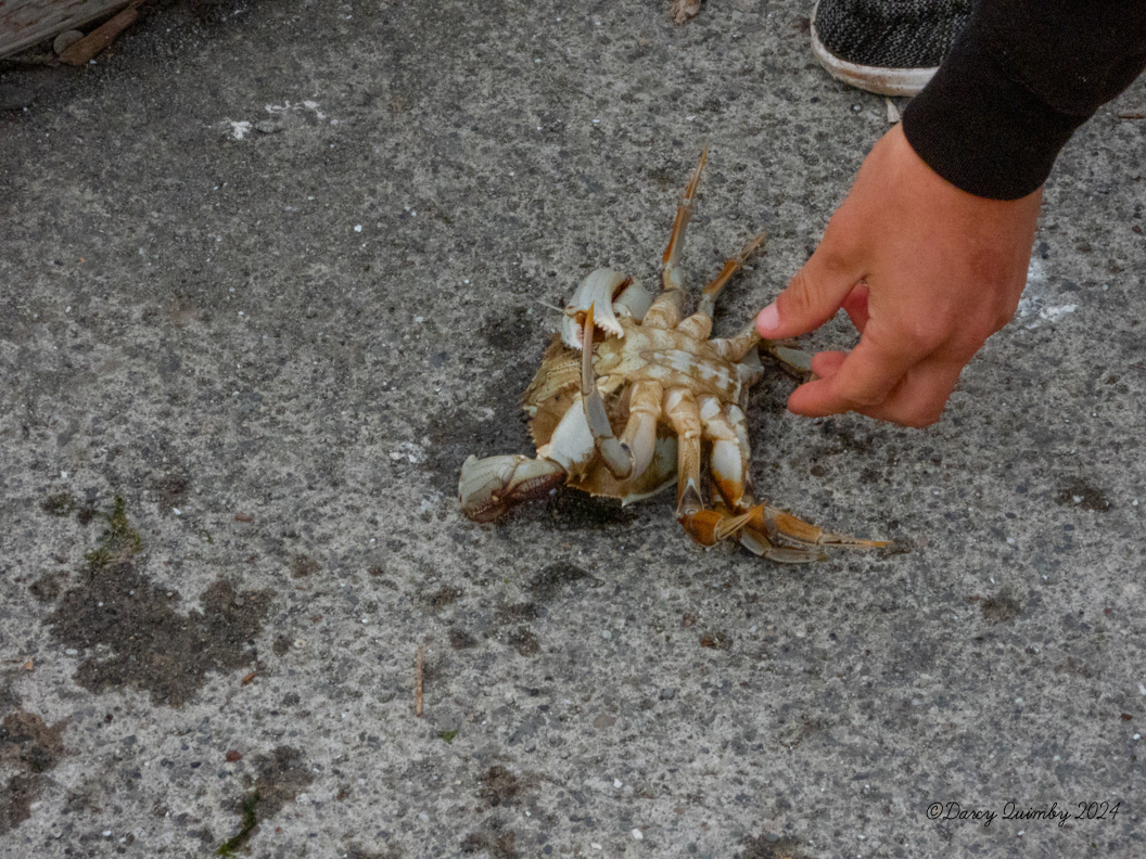
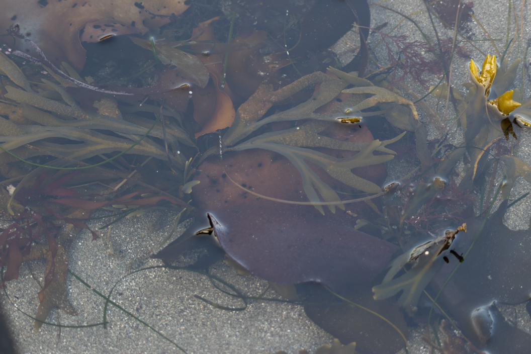
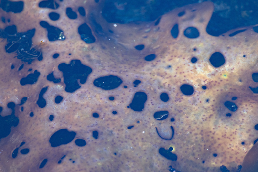
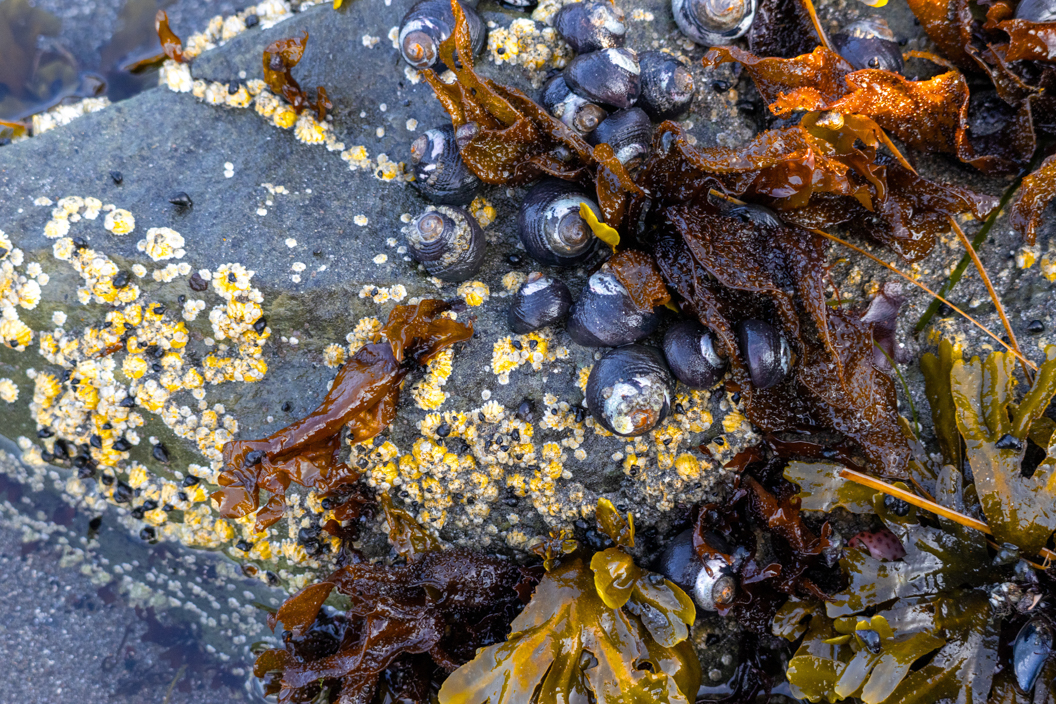
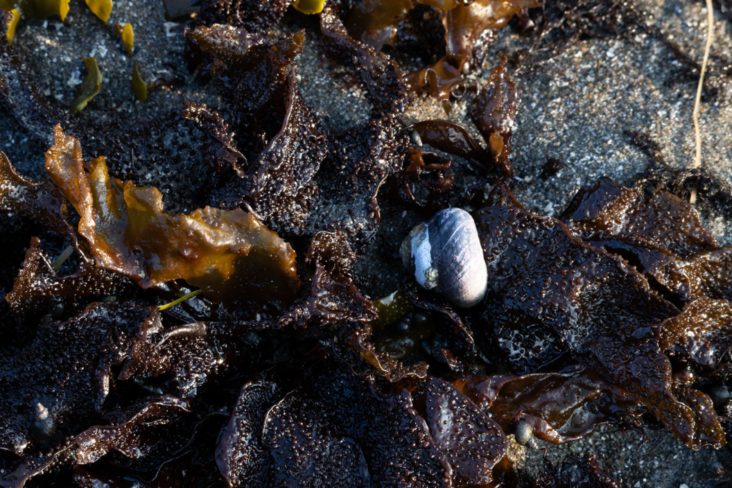
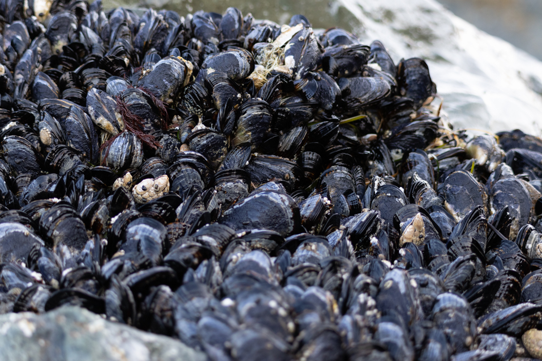
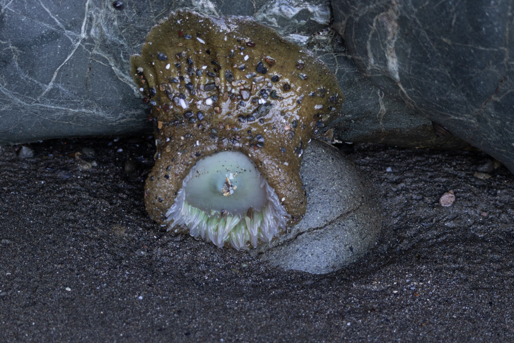
In making it I was rewarded by getting close to the tide pools. The tide was coming in, so I did not see much exposed sea live. Except for the zillions of muscles. Check out the video below that shows the ocean up close along with some of the tide pools.

One of the pluses to traveling in Oregon is how accessible and wheelchair friendly the outdoor parks and attractions are. I am just getting out and enjoying Oregon, our new mobility van and my fantastic iBot wheelchair.

Kids ask the honest questions

This is what happened Saturday night when I was at Harris Beach photographing the sunset.  This was the first time I had been to Harris Beach since I got stuck in the sand.  That is a story that will be covered shortly in its own blog.  Harris Beach is perfect for sunset shots and is very easy to navigate around. The sun sets in a way so, anywhere in your shot, you can get the beach or rocks.  Plus, this is a very popular spot for people, sunsets, and silhouettes.

As I said, this was my first time back.  So, to say the least, I was gun shy.  I went to the ramp and saw this ‘shelter’ built by someone out of driftwood (the sun was perfect). 

Snapped a picture. Then, I decided to go on the grass, which is a semi bumpy hilly area that was facing the setting sun.  It wasn’t the type of sunsets that are easy to shoot, but you can get some interesting results.

I’m going to back up a little bit and mention you don’t know if you don’t go.  There were no fluffy sunset clouds, just a bank of clouds at the horizon. So my thought was it won’t be good.  I am glad Roy doesn’t listen to me sometimes. (I will deny this comment in the future. 🙂 ) I am also glad I listen to Roy sometimes.  We were just heading down to a restaurant that is about a block from the RV Park.  I was like, do I need my camera? Roy said, ‘Remember you never know what you might see.’ 

Well, I went into the trailer to get the camera on my way out of the trailer, I looked up.  So, glad I did because I saw three turkey vultures soaring overhead.  They were out of range of my camera to photograph, I just enjoyed them.  At this point and time at a little lower elevation, there appears a bald eagle.  It took my mind a minute to realize what it was.  Sometime. You just have to absorb the moment.  I thought it was amazing how the light hit the white tail feathers, then he was gone.

Back to what happened at Harris Beach. I’m snapping away, and then I see this guy/mountain goat climbing up this rocky hill to get a better viewpoint.  I decided his climb and the profile of him shooting the sunset would make some good photos. 

He saw me taking photos of him when he got down he asked if he could get a copy.  Of course I said. He gave me his number and we chatted about cameras.  I have learned, though, that when shooting a scene, talk less shoot more.  I got a few more shots once the sunset behind the bank, packed up, and got ready to load up.

I am still wanting to hit the beach, but I’m a tad shy.  I see this group of people come up, a trail that I have been curious about since last year. I can see just the top of the trail.  It is wide enough but, not sure what is out of sight. I’ve become quite bold. I see a group of people coming up that same trail. So, I ask if this chair could make it down.  I also asked what it looked like at the bottom.  I guess there is a big driftwood log near the bottom you have to work around.  There is also a dropoff that looks like steps right out of sight. Oh, well.  I will get on the beach sometime this summer.

As I’m talking to the adults, a boy who was about 6 years old  pops out this question. Why are you in a wheelchair?  I said I have Multiple Sclerosis.  The boy seemed satisfied, especially after the dad leaned over and said, ‘that’s, what Jean has.’ I have  to wonder how many adults have that same question and are afraid to ask it when they see someone in a chair.

I know that for me, it is easier to answer a child than to answer an adult. I find some adults to be a little condescending or even disapproving because I have no outward injuries.  I have noticed. When I see an adult look or show some interest, I am quick to say I have MS. It was amazing to hear the curiosity and honesty in the boy’s question.

I hope that you take away from this post that it is ok to ask why I am in a wheelchair just please ask out of wonder and honest curiosity.

Clawing through the day

I have enjoyed just hanging out at the mouth of the Chetco river, this is the end of a 56 mile stream. So when low tide is happening and we have finished our errands for the day I see what the river has to offer. Friday the 30th of August I knew that this was probably going to be my last day to hang out before we head out. So we decided to hang by the mouth of the river.

There is a spot near the south Jetty of the Chetco river, where if the tide is low enough and the rocks are exposed. Pelicans love to hang out there. Further down the jetty near the harbor is the area where people crab. They actually are able to crab all up and down the river, but prefer the area near the Coast Guard station. If the wind is up, Danny from Brookings Kites will fly some of his gigantic kites. Today was not the day for his kites.

Here are some photos of the pelicans hanging out. I understand that the pelicans were here to eat the bait fish in the river. I don’t think these pelicans were interested in eating.

Off we went to see if there were any crabbers by the Coast Guard Station. As luck would have it, a family had just started to crab. They set up a fishing pole trap and a round castable crab trap.

I asked if I could hang out and take some pictures. It was also an opportunity to get a quick course on how it is done. The fishing pole trap is one that you have to pay more attention to. Once dropped it opens up on the bottom of the river, exposing the bait. The crabs come in and pick at the chicken leg; they can pick it clean quickly because it just lays on the trap. You pull this up, the trap closes and you are left with a crab in the trap. If it is close to a keeper, you measure it. If it is not a keeper, just open the trap and let the crab fall back in the water. Check out this method in action in these pictures. If you notice, the chicken leg stays in the trap.

If they do get a keeper or one they have to measure there is an added step or two. They dump the trap on the dock, check to make sure if the crab is the right size which is 5 3/4″ or more.

They also make sure it is a male. You have to release the females and the undersized. Follow this link for more information on how to crab in Oregon.

The round castable crab trap needed a good discus thrower. I say this because you want to get it out a bit from the dock area. The chicken leg is encased in a mesh compartment which makes this trap able to stay on the bottom longer to attract more crab. Both traps will fold up when raised off the bottom of the river. Any crabs sitting on the trap get a ride to the surface.

Once the trap is up, the fun begins. Looking at the trap once it is brought up you can kinda tell which ones might be keepers. So, you know what ones to measure once the trap is open. I did two things when the trap was open 1. tried and stay out of the way 2. protected my feet. (images of a crab clamping on to my toe were dancing in my head.)

Just a few more interesting tidbits I learned when a crab claw is lost or broken they have the ability to regenerate the limb.

When a crab is dropped back in the water, it sometimes floats and looks large enough to be a keeper.

The fog decided to roll in which meant it was time to head in for us. I sure enjoyed crabbing with this family. When I left they had three keepers.

‘The Thing’ was……

I was able to get up close and personal to a tide pool and the ocean. I will say that it took me a couple of days to recover. How did I do it and why did I do it? I had my cane, a friend, determination, and grit. That is the how; the why is that I wanted to see a Sea Star (starfish), feel wet sand, and do this before there was no possible way I could.

After I told Roy what I wanted to do, we went back to the trailer, and he worked his magic with Google. Amazing skill he has; just by looking at a satellite map, he is able to figure out if this is a viable spot for tide pools or whatever. The plan was to figure out if it was possible for me to do the walk out and still take photos. We decided to head down to Lone Ranch Beach to see if I could actually make it down to the beach. I did grab the cane and my Nikon. Armed with Roy’s Google knowledge, I headed down the path at a very slow rate of speed.

Once arriving on the beach, I realized that I had chosen the wrong path to walk down, putting me in the middle of the beach. I thought it was a long way to walk to reach the rocks. I also realized that I have a really long zoom camera, so not much walking was needed today. It was an interesting feeling to be this close to some powerful waves and the sound of the ocean. I did ask a few people on the beach where I could find sea stars or anything today. Unfortunately, the tide was not out far enough.

The next morning, I invited Meagan to join me in enjoying the tide pools and helping me navigate the area. I am one of those people who love to hear and watch nature but am not a touchy person. We start down the new trail and right off the bat Meagan sees a snail.

snail
camouflaged

She picks it up and moves it further along the trail so I can take the picture. She also touched the tide pool and made a fish move. I am thankful she did that because if not, I would have missed some pictures. She then discovered the crab; this made me more aware of what hangs out under the sea.

My takeaway from all this was that these sea creatures, plants, and rocks are exposed to people only when the tide goes out, and then it depends on whether the tide goes far enough out.

I had a feeling of wonder and awe. I was also reduced to a few words, sometimes just a few sounds, like “oooh” and “aaaah.” Check some of these out.

It was about this time as we were out in the ocean that Meagan said the tide was coming in. I grudgingly decided it was time to head back to dry land. I have a feeling that this is not my last tide pool visit. The only requirement is that it will have to be closer to the shore.

Hail Yes

hail

Hail drops. It is one step removed from snow. I am taking bets that as the snow magnet we will have snow before we leave here. Today was a needed break as we went through Spearfish Canyon scenic byway on Thursday.

This meant getting up early and heading about an hour and a half north of here. We started at the end of the drive Cheyenne Crossing and ended in Spearfish where the trail begins. This was the plan because the most strenuous and IMO the most beautiful falls is Roughlock Falls. There is a two-mile round-trip path to the bottom of the falls, and back again the path is paved and fairly level until you encounter three very steep inclines at least for a wheelchair. I will have to admitted why they give you the warning not to go down steep inclines because you have to get back up. After I made it down the second incline and saw the third incline I turned around and headed back up. Smart decision. ( I almost tipped over) So here is two of the pictures I snapped at these from the last viewpoint I could safely navigate.

Before we did the adventure at Roughlock Falls we pulled into a turnout that I don’t know the name of, or if it had a name. The water was amazingly still so I had to take my anytime there is a reflection picture. I also experimented with some Depth of Field zooming in on flowers with the river behind them. I pulled out my chair for this which helped my traverse the whole pullout. I found this yellow and black butterfly flying around my chair landing and taking off

Bridal Veil Falls

After Roughlock falls we drove to Bridal Veil Falls the pull off for this was on the other side of the road from the falls so, back in the chair and off I roll to take some photos and a short video.

Like I said earlier I’m glad this was at the end of the canyon byway.

On the way home we stopped by Sturgis which sure looks and sounds quiet. The Biker Rally isn’t until August, so Sturgis feels like a small town that it is. We did a quick run through Wildlife loop (buffalo were on the wrong side of road for photos). before heading to dinner and a show the play was at the Black Hills Playhouse which is in Custer State Park. The dress rehearsal performance is give a donation, and you can see the play.

Pulling in after dark we were treated to deer grazing in the campground, there was about 12-15 on both sides of the driveway.

We’ve been in one spot for over a week now, this feels good. I’m looking forward to some fun this summer.

Not the Tunnel of Love

But it was a tunnel, all 11,112 ft of it. The Eisenhower tunnel outside of Denver is a feat in itself. The tunnel consists of two bore holes, the west bound tunnel (Eisenhower) was started in 1968 and completed in 1973. The east bound tunnel (Edwin C Johnson) was started in 1975 and completed in 1979. Today, if you have hazmat materials or you are too tall for the tunnel, you have to go 9.1 miles out of your way. This road has hairpin turns and you go over Loveland pass on US 6 the elevation is 11,991. In reality, the tunnel was short, but it made an interesting impression on me. If you want to learn more, click here https://codot.gov/travel/ejmt

tunnel of love

Well, you’ve now read the apex of the day, so how we got there is also interesting. We left Fruita Co bright and early so we could travel all day through some beautiful scenery. I have to say I was impressed to still see some snow on the side of the road. Even more impressed that we got to drive through slush. Had we been a little later in the day, it would have been snow. I am the snow magnet and that’s a fact. Aside from the slush I could not believe the amount of people and houses on the mountain. Going through Vail, Roy commented that it used to be a small ski town. Not anymore there is a West Vail, downtown, and East Vail.

snow on the mountain tops

Driving next to the Colorado River and seeing the high water level, I know that means gains in ground water. there will be plenty of ground water for us. We even saw a few rafters on the river.

After arriving at our home away from home for 3 months, we found that our cell and hotspot are very limited. Other than the cell service and nightly rain. We made the right choice. Today was our first trip around wildlife loop and yes, I’ve seen some buffalo. Pictures and video to come soon.

Way TOO Many People

Dip netting. (I borrowed this video from YouTube). I did not have a drone to capture the massive amount of people. They were close together and it made me wonder how the salmon chose which net to get caught in.

the beach
looking at all the tents

The fact that dip netting is only open to Alaskans is amazing and good. It is called Subsistence Fishing this allows for Alaskans to fill their freezers for the winter. Here is a link to the permits required. We went to the Kasilof River on July 9th to experience the sight of salmon getting entrapped in a net. It was so overcrowded they were even parking under signs that said no parking anytime.

NO Parking
No Parking

It is interesting to learn that a permit is required and that you have to clip off the end tips of the tail this is to distinguish the fish that were gotten during dip netting and the ones caught with rod n reel. (Which has been hard to do this week July 17th too much rain means swollen rivers). Speaking of rain this is why I am catching up on blogs and photos. We extended on the Kenai to maybe get a few more pictures. We’ve gotten rain and a few less pictures. I got sidetracked back to better weather and the drive up the Peninsula.

Is it safe now

We headed into Kenai so I could do some grocery shopping. Headed towards Kenai on the Sterling Highway was where I was treated to seeing two moose. Roy was able to enjoy also but they were on my side of the car. (So, I was closer.) The first one was just hanging around a dirt lane popping in and out of the tree line.

What are you looking at?

The second moose was just chewing and minding her own business along the side of the road. I took some pictures and we headed onward.

a large chariot
the terminal

On we go to get me salad stuff which Roy struck out with Safeway. It was early yet so we decided to find out where the bear viewing boat trip left from so, we knew where we were going and how big the planes were. I was surprised at how rough the roads were getting out to the Alaska West Air, water terminal.

ready

Sitting in the parking lot I got lucky and was able to catch a plane taking off. The taxi way is also the landing zone.

lift off

After a full day of travel, we almost found everything for my salads. Roy still had to pick up lettuce and some onions from Wal-Mart because Safeway didn’t have any. No onions but we were able to get fresh leaf lettuce and some farm fresh eggs. Roy pulled one of his favorite u-turns for a roadside stand that advertised fresh veggies.

The enjoyable thing about driving some of the backroads is you never know what good farm fresh things you’ll find.

One Last Ship Post

Pictures say 1000 words. Other then the cold I caught this was an awesome ride with mountains, snow, and water. Enjoy the photos.

Things that stood out to me on the ferry ride

  • The scenery be it foggy mornings or bright mountains
  • Considering the last two years we’ve had, the amount of cruise ships that are floating, Just unreal. In Ketchikan Alaska alone there were 4. We also ran into 2 more going the opposite direction.
  • Whittier Tunnel this still freaks me out. One lane road, driving over active railroad tracks in a tunnel. I think it is because my mom always said ‘Don’t play on the railroad tracks.’
  • Being on the water for 1,629 miles and not getting sick

Now that I’ve gotten my land legs back and I will catch you up on this leg of the adventure.

Rainy Day Road Trip Turned Out

The Rain

Perfect. This was because we got to do the driving in the rain and wherever we stopped there was a rain break. I do have to say on a side point Roy is getting to drive more curvy and single lane roads then ever before. I on the other hand am looking for the motion sickness pills. (just kidding) I only bring the point up because we decided to head to Hot Springs on a rainy Saturday to stay away from any crowds in the Park.

Large and in Charge
A Buffalo

87 is a mostly two lane paved road that takes you through the northern end of wind cave, supposedly elk and buffalo hang out in the area or at least that is what the signs say. We did see some buffalo but no elk. I say mostly 2 lane except for a one lane bridge this was a short one. At the junction where 87 joins 385 there is another prairie dog town, however they were not as hyper or active as the other ones we ran across. So on down the road. The actual Wind Cave visitor center is off of 385 so I had to at least go shopping. Unfortunately due to the popularity and the limit in available tickets I did not go into the cave. (this year you had to be in line for tickets at 7 am and then come back at your tour time. I did however hit the gift shop, I got 2 t-shirts, a hat and one small stuffed prairie dog affectionately named ‘Sticks’ from ‘Live PD’ fame. I figure with the number of dogs we have seen it is all good that I bring one home. After the side trip to Wind Cave we headed down to Hot Springs.

Let’s Dig

This is a town that has a story to tell, almost like it is stuck in time and that it has an old time small town feel. The town is famous for their Mineral Springs and The Mammoth Site outside of town. The town also has the South Dakota Veterans Home and Veterans Hospital with restored old buildings. The town also had a lot of the old buildings fixed up. Roy had a craving for a corn dog because he saw the sign for it at the local craft fair. I decided then to walk the craft fair it reminded me of small town America. In the middle of town there is a waterfall that you can see the mineral build up of the water, the flag at the top of the waterfall was placed to honor Veterans by the local VFW. All in all the rainy day trip turned out to be the pot o’ gold at the end of the rainbow.

The Flow
Falling Water